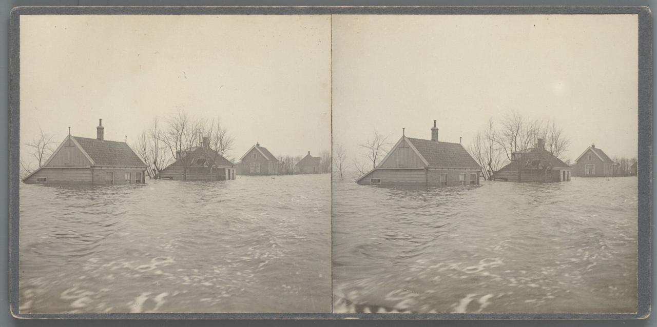
Flooding 1916
In the early morning of January 14, 1916, the Waterland landscape turned into a churning sea. The dikes at Katwoude and Uitdam broke under the pressure of a raging northwest storm. Water from the Zuiderzee flowed violently into the land. Within a short time, Amsterdam-Noord, then still largely rural, was largely under water. Around the Buikslotermeer area, the damage became enormous. Houses flooded, fields disappeared under meters-high water, and through roads became impassable.
Where Buikslotermeer Square is now, an inland sea had formed at the time, up to six meters deep in some places. Panic broke out in villages like Buiksloot and Nieuwendam. Refugees from surrounding areas brought the news that the water was coming. Farmers chased their cattle to the higher parts of the city. The Buiksloterstraatweg became clogged with cows, pigs and sheep on their way to the Tolhuis, where people and animals were temporarily sheltered. As if the flooding wasn't enough, an icy snowstorm followed in February that compounded the suffering. The water retreated only slowly. Many homes were damaged or uninhabitable, crops lost, lives disrupted. The disaster left deep marks. At the same time, it made the weakness of the dikes painfully clear. This catastrophe would eventually contribute to the decision to close off the Zuiderzee - and also accelerated the annexation of the affected villages by Amsterdam in 1921.
Any feedback for this story?