Urbanization of La Barceloneta and Eixample
These two revolutionary urban projects transformed a suffocating city into one of Europe's most distinctive capitals. By the mid 1850s, the medieval walls had become a death trap: 187,000 people crammed into just 2 square kilometers, where each cholera outbreak killed 3 percent of the population. Where the Mediterranean once reached inland, La Barceloneta rose from reclaimed land in 1753.
Engineer Juan Martín Cermeño designed this triangular neighborhood with its strict grid of orthogonal streets to house residents displaced by the construction of Philip V's fortress. Fishermen and factory workers filled the narrow streets, and the massive Maquinista Terrestre y Marítima foundry employed over 3,000 workers. The walls finally fell in 1854.
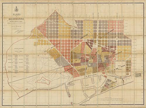
Civil engineer Ildefons Cerdà proposed Eixample, meaning expansion, and invented the science of urbanism to support it. He calculated the exact volume of air needed for healthy breathing and proved that narrow streets increased mortality. His plan featured octagonal blocks with 20 to 60 meter wide streets, designed for trams and railways that didn't yet exist.
Though developers ignored his vision of green courtyards and low buildings, Cerdà's grid became the framework for modernist masterpieces. His plan transformed the plain between the old city and surrounding villages into what became the most populated district in Spain, home to over 250,000 residents.
Any feedback for this story?