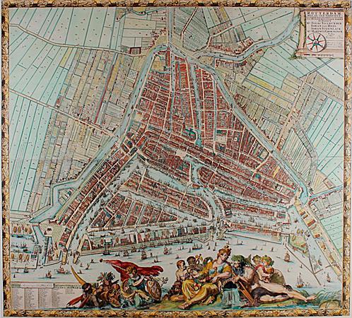
The City Map
Take a close look at this map—can you recognize the shape of Rotterdam? The city’s triangular layout, with the Maas as a natural border, stands out clearly. This is the famous 1694 city map by Johannes de Vou and Romeyn de Hooghe. More than just a map, it’s a work of art showing Rotterdam’s pride and prosperity in the 17th century. The city’s leaders, wanting to rival Amsterdam and Leiden, commissioned an impressive map. Johannes de Vou created cityscapes and a skyline, Romeyn de Hooghe handled the design and etching, and surveyor Pierre Ancelin ensured accuracy.
The map blends precision with symbolism. Around it are city views, coats of arms, and at the bottom, a scene showing exotic goods being presented to the Maiden of Rotterdam. A symbol of economic growth, but also a reminder of slavery and colonial exploitation. Six hundred copies of this wall map were printed. They adorned the offices and homes of key figures and remained in use until 1795.
Today, it’s a treasured historical document showing how Rotterdam grew in the 17th century.
Any feedback for this story?